Lesson Name: Looking at Zoning and Neighborhood Change
Primary Museum Pedagogy: Physicality, Narrativity and Materiality
Course Title and Description: Lehman College HIU348: History of New York City and State (Spring ‘18)
Lesson Overview: In this lesson, students embody images of different parts of New York City, consider how zoning affects physical differences in neighborhoods, and then consider the pros and cons of rezoning.
Skills
- Visual analysis
- Working as a group
- Critical thinking
Pedagogical Considerations:
- This lesson has distinct phases which vary the activity and keep students engaged
- Much of this lesson is observation-based and game-based; students are asked to look closely at images and then to guess which group is reenacting which image; it encourages students to interact and strategize with each other with the teacher acting as a facilitator rather than a font of knowledge.
- This lesson is open-ended; students are ultimately asked to think critically and use sources to explain their conclusions, but a multitude of conclusions are possible.
- This lesson may work best split into two days, with more time spent on researching zoning debates
Content Objectives:
- Students will consider density and use in different neighborhoods
- Students will learn the history of zoning laws and what zoning regulations are in place today
- Students will delve into present-day debates about rezoning, upzoning, and downzoning
- Students will consider neighborhood character and neighborhood development from the perspectives of different stakeholders.
Key Terms
- Zoning
- Density
- Mixed-use
- Upzoning
- Downzoning
Materials:
- Five images of different New York neighborhoods
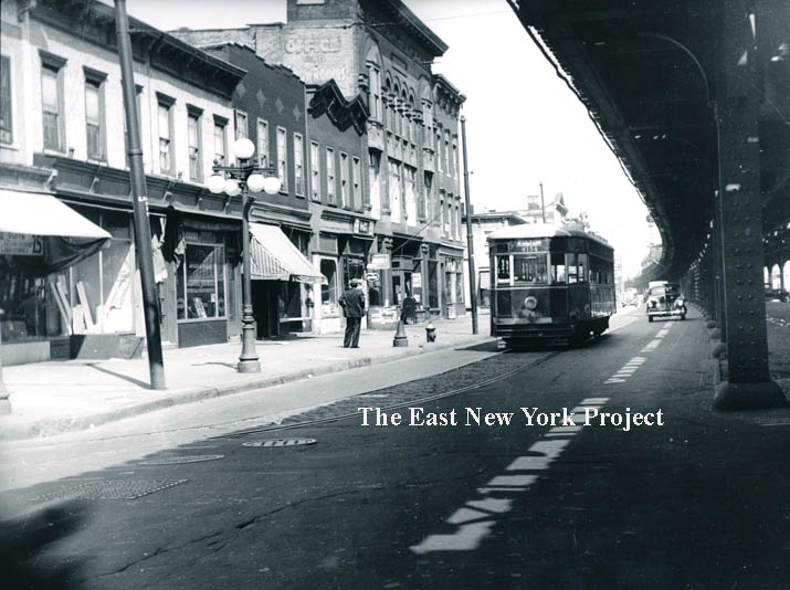
- http://www.tapeshare.com/Atlantic/AtlEasttoAlabama1942c.jpg (East Brooklyn, 1942)
- https://digitalcollections.nypl.org/items/510d47dd-6691-a3d9-e040-e00a18064a99 (Percy Loomis Sperr, Long Island City, 1940)
- https://timedotcom.files.wordpress.com/2012/05/85.jpg?quality=85&w=722 Staten Island, 1980s, Christine Osinski)
- https://static01.nyt.com/images/2016/05/25/blogs/25-lens-rosenthal-slide-CDXF/25-lens-rosenthal-slide-CDXF-superJumbo.jpg (Mel Rosenthal, South Bronx, 1970s)
- http://www.toddwebbarchive.com/archive/new-york-1946-1959#13 (Todd Webb, Harlem, 1946)
- New York City zoning website
Part I–Lay of the Land (15-20 minutes)
Students are asked to take a “gallery walk” around the classroom, where 5 numbered images of different New York neighborhoods have been placed at intervals. Images are cited (place, date, artist) on the back for reference. Students write notes about their reactions to/observations about each place. In addition to anything they want to include, they are asked specifically to weigh in on:
–What types of buildings do you see? (height, a lot/a few, materials made of)
–What people, if any, are in this picture? What are they doing?
–What other objects are present in this image?
–What is your overall impression of this scene, in 5 words or phrases?
Afterwards, in groups of 4-6, students discuss what they saw. Was there a collective favorite neighborhood? If so, why? If not, why? What words did people use to describe the different neighborhoods? Do any of these images remind you of your own neighborhood? What’s similar/what’s different?
Part II–Become the Neighborhood (15-20 minutes)
Each group is assigned one of the images to reenact as a tableau. Students will strategize about what parts of the image are most important to communicate. Students will strategize about who will embody what in the image. Afterwards, each group, in turn, will enact their tableau for the rest of the class, with the class trying to guess which image each group is. Classmates may interact with the tableau by tapping students on the shoulder to “hear” from them: a student may say what they imagine a person, object, or building in the image is thinking.
After all the tableaus have been guessed correctly, have a brief discussion all together about how students worked on their tableau. What were the main features of their image? What choices did you make in order to communicate your image to the rest of the class? What are the distinctive qualities of the neighborhood you were assigned?
Part III–Considering Change (10-15 minutes)
Each group looks up their neighborhood (as close to the original location as possible) on Google Street View. Consider as a group: what has changed in this neighborhood, and what has stayed the same?
Search for your neighborhood using the city’s zoning map. What zone is your neighborhood? What kinds of buildings can be built there? Has your neighborhood’s zoning changed?
Part IV–Contextualizing Change (15-20 minutes)
As a group, search for articles about rezoning, upzoning, and downzoning in your group’s neighborhood. What do each of these terms mean? Is your neighborhood slated for rezoning or has it been rezoned since 2000, and if so, what kind? Who wants it and who opposes it and what are their reasons?
Come back together as a class and report on the status of each neighborhood. Does your group agree with the current zoning of your neighborhood or do you think it should be rezoned? Do people in your group disagree?
Part V–Taking a Position (5-10 minutes)
After considering what zoning is and how it shapes neighborhoods, and hearing the views of varying stakeholders, what do you think about rezoning? Do you mostly oppose it or mostly support it?
Students will indicate their position on the “human barometer,” where they are asked to physically stand on a spectrum in the classroom indicating the degree to which they support or oppose rezoning. The teacher taps on individual students in different positions and asks them to clarify their reasoning: if you’re in the middle, why? What information affects your position?
Extension Activity (at home)
Design your ideal neighborhood of 1-4 blocks and create an image of it (aerial view or street view) What does it need? How many people can it support? Is it more dense or less dense? What official zone is it most like? What are the best things about it, and what are some shortcomings or vulnerabilities? Is it inspired by any real part of the city?
Pingback: Introducing New Digital Resource: Museum Pedagogy in the Classroom – Visible Pedagogy